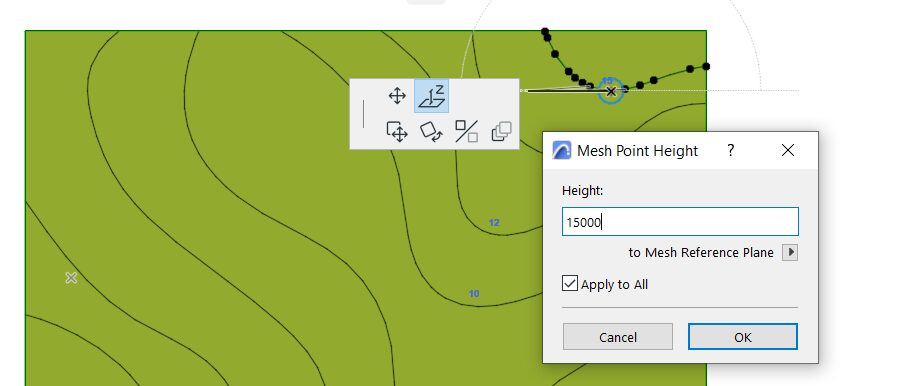
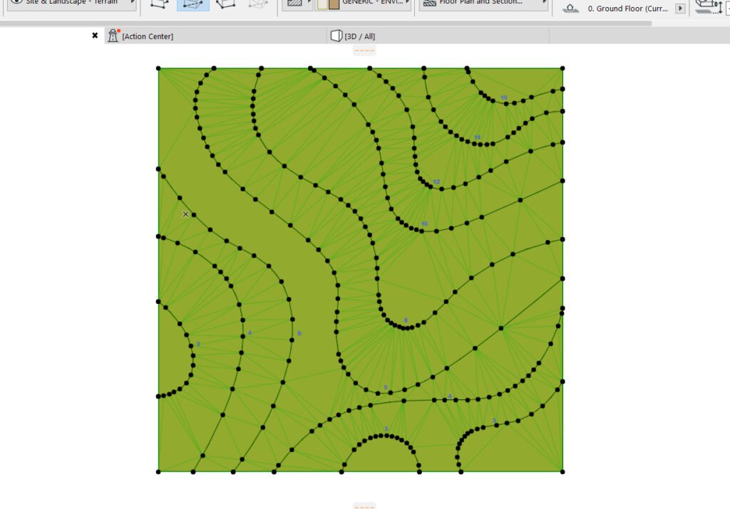
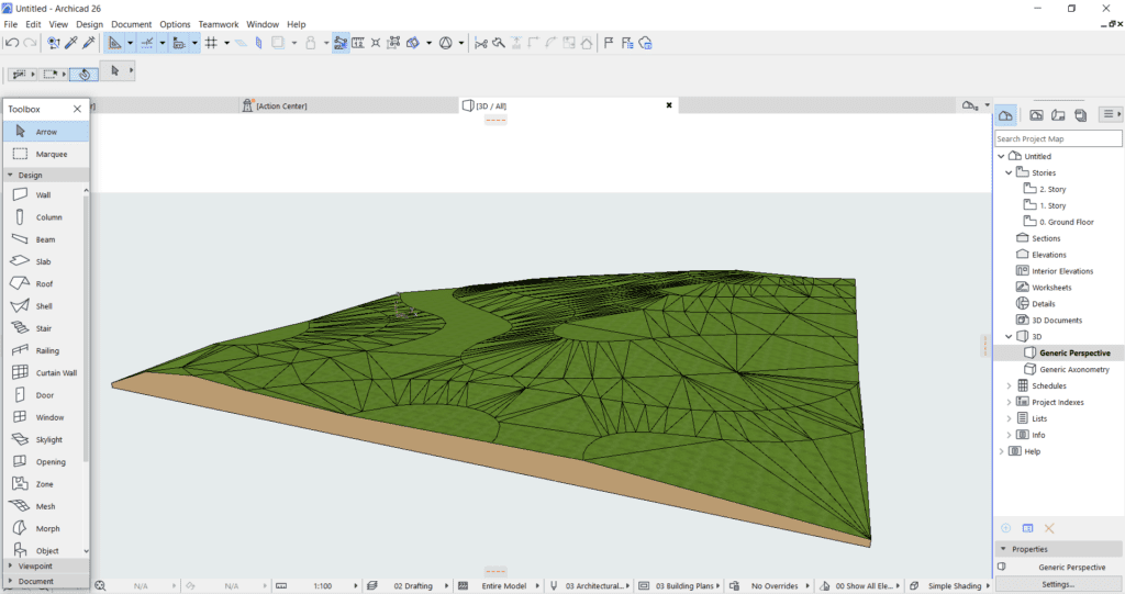
drafting

How to Use ArchiCAD’s Mesh Tool

In terms of its basic physical structure, mesh performs similarly to slab in ArchiCAD. However, in particular, the mesh tool is useful for representing irregular geometries like terrain models, complex details, and other free-form structures. Most importantly, mesh primarily functions as a massing tool for different topographies. Slab, on the other hand, is primarily used for creating floor slabs and other horizontal elements. Although, it’s still possible to use slabs for flat topographies with zero terrain relief.

When working with different terrain levels, the mesh tool is the ideal choice. A sample terrain with contour lines is shown below.

ArchiCAD's mesh tool

General Overview 

1. To use “Mesh”, select it from the ArchiCAD Toolbox. Create the “Mesh” by defining its vertices and edges. You have the option to choose a pre-made shape (rectangle or triangle) from the available options, or you can use a “Polyline” for an irregular shape.

ArchiCAD's mesh tool

2. Once you’ve created a “Mesh”, you can edit it by selecting it and using the editing controls like moving vertices or adding/removing edges. To add a contour line to the mesh, click on it, hold the Alt key while pointing to the mesh’s surface, and press the spacebar to activate the Magic Wand tool.

ArchiCAD's mesh tool

3. When activated, direct the wand toward the contour lines. A dialog box will then appear, indicating that you are adding mesh points.

ArchiCAD's mesh tool

4. Elevate these contour lines by clicking on any node that aligns with the contour lines. This action will open the Mesh Point Height Dialog Box. Input the height as indicated in the topography. Repeat the command for all contour lines to set their respective heights.

ArchiCAD's mesh tool

5.  After everything is set up, review the 3D view to verify if it was successful. Once everything appears to be in place, you will have a 3D representation of your topography.

ArchiCAD's mesh tool

When dealing with varying terrain levels, the mesh tool is the preferred choice, as it excels at accurately representing topography, as demonstrated by the sample terrain with contour lines. Furthermore, the mesh tool can also be effectively applied to skirted surfaces and solid bodies, including complex roofs. Utilize this tool in ArchiCAD and make this as your guide to create any surfaces in your model. 

Was this insightful? Give a thumbs up or post a comment.

For more of our blogs, check out https://mgsglobalgroup.com/blog/

Connect with us!

Trending

Podcast
with Jing Lauengco

Get the latest blog

440660cookie-checkHow to Use ArchiCAD’s Mesh Tool
Subscribe
Notify of
guest
0 Comments
Inline Feedbacks
View all comments